BORGO DI TERZO – SAN FERMO – MOUNT GREMALTO – MOUNT BALLERINO
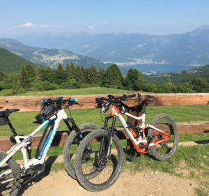
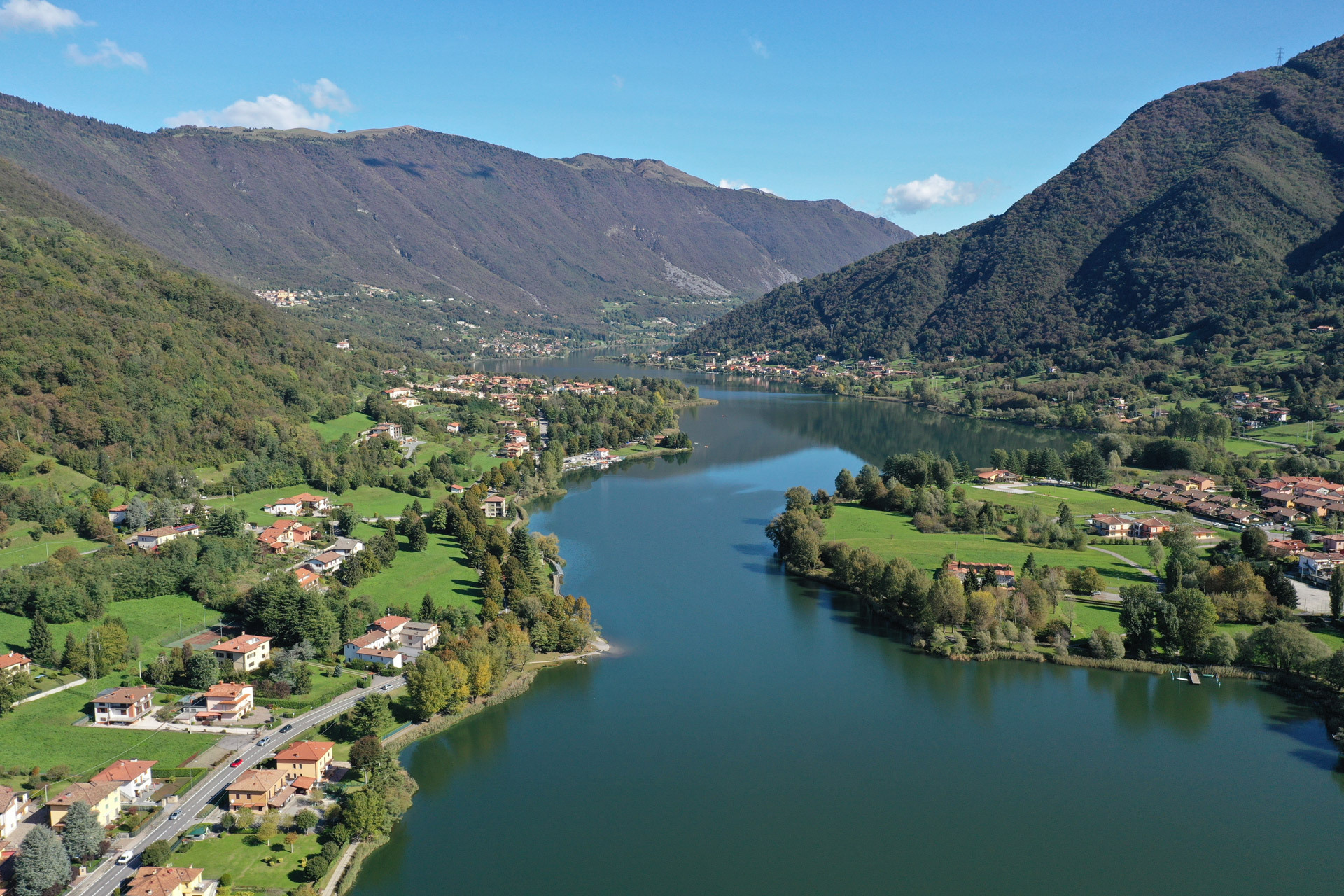
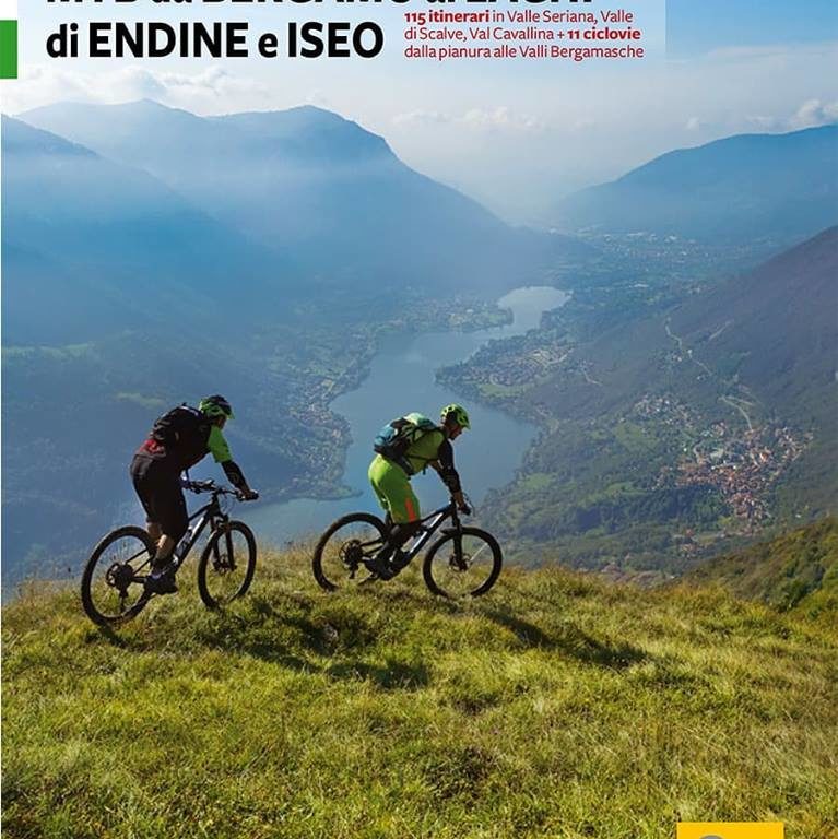
A wonderful loop ride along the slopes of the Colli di San Fermo, offering breathtaking views over Val Cavallina. The descent via the Ballerino trail is part of a “poker” of trails every biker should experience: the Sicolo trail, Valle d’Adrara trail, and Bronzone trail.
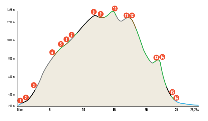
The tour can be divided into three main sections. The first involves a challenging climb from Berzo, ascending the slopes of Monte di Grone via steep cemented roads. This leads to Foppa di Fra, where a long diagonal begins, traversing dirt tracks, paths, and eventually asphalt to reach San Fermo and Colle di Caf.
The second section features an easy and scenic ride along paths and dirt tracks that follow the ridges overlooking Lake Endine, passing the peaks of Mount Gremalto and Mount Ballerino.
Finally, the third section is the descent, which offers a diverse range of terrain. You’ll encounter everything from smooth, soft surfaces to technical, rugged challenges with obstacles and steep sections. A ride not to be missed!
ITINERARY DESCRIPTION
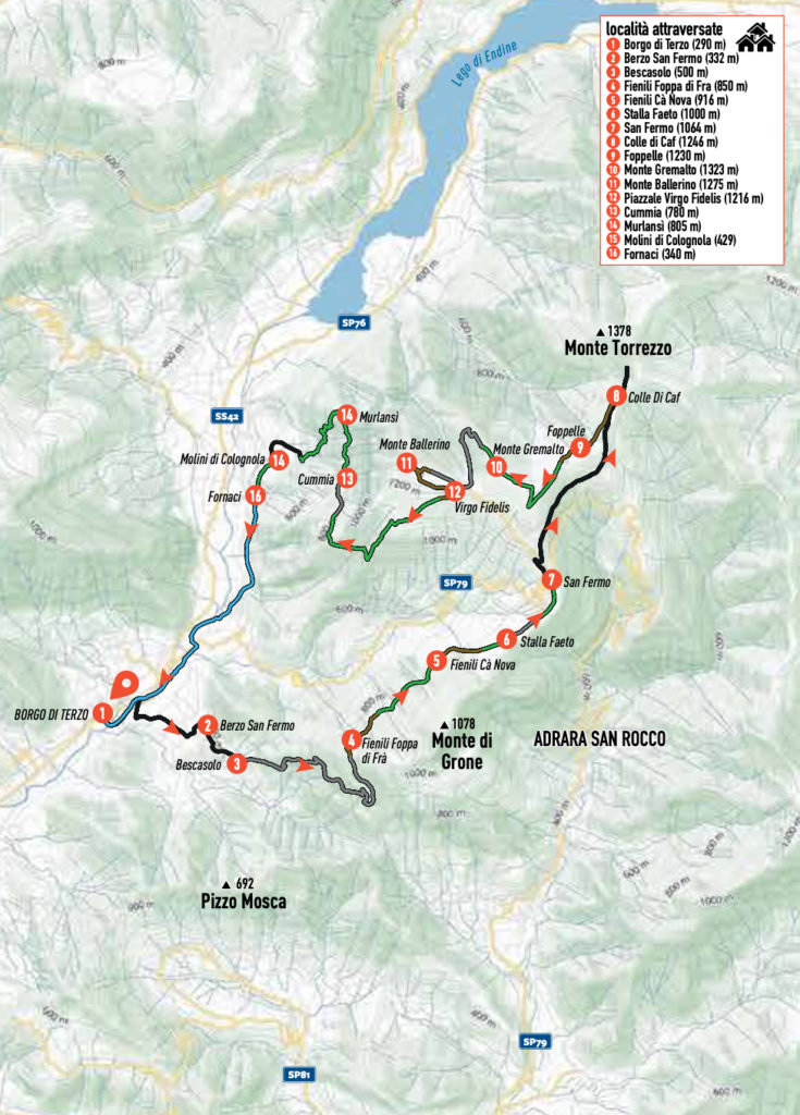
Once in Borgo di Terzo (1), turn right following the signs for Berzo San Fermo (2). After crossing the bridge over the Cherio River, turn right to park near the cemetery. Begin on asphalt, climbing towards Berzo, following via Bergamo. After a bend to the right, the road starts ascending (do not continue straight along the cycle path). At the parish church, cross via Bergamo and via Sant’Anna; at the shrine, turn left onto via Monsignor Trapletti. At its end, continue along via Cesare Battisti. Near the little church of the Immacolata, leave the village and continue, still on a level path, along via Bescasolo. At the junction with via Balconata, the road begins to climb. After a bend to the right, where the road flattens out, leave via Bescasolo (3) and turn left onto a steep, narrow road with a cemented bottom, following CAI trail marker 615.
From this point onward, there is no respite: the small road continues steeply through meadows and woods, with century-old chestnut trees and beautifully restored farmsteads. Climb up to an altitude of 850 meters, where, after a steep ascent passing near two farmsteads, a hairpin bend to the right branches off two dirt roads to the left. Here, the steep uphill section ends; take the second road, which winds around the ridge, leading to Fienili Foppa di Fra (4). Continue along the dirt track, which, on a level surface, crosses the western slope of Mount di Grone and enters the Faeto wood, following CAI signposts 701 and 619. The road ends here, and a beautiful single track begins, which ascends slightly with very short push sections, leading to the locality of Fienili Cà Nova (5). From there, return to the dirt road.
At the crossroads, take the small road to the right marked CAI 614, heading toward valico di San Fermo. Once on the ridge, at Stalla Faeto (6), follow the path that, between two dry stone walls, crosses the meadows until you reach a small road that faithfully follows the ridge, ascending to the Valico and the small church of San Fermo (7). Here, the three asphalt roads from Grone, Adrara, and Vigolo converge.
Go up viale dei Fiori and, after about 300 meters, turn right onto via Torrezz, following the signs for “Monumento Partigiani”. The road climbs gently, reaching Colle di Caf (8) and immediately afterward the Monumento Partigiani, located just below the summit of Monte Torrezzo. At Colle di Caf, turn left onto a dirt road (CAI signpost 612A), which follows the ridge toward Gremalto, passing through a forest of repeaters and antennas. The dirt road ends near the well at Foppelle (9).
On the right side of the puddle, beneath a “roccolo”, take a rideable path climbing the southern slopes of Mount Gremalto (10). Reaching the southern ridge, turn right and ascend briefly to the summit. To the north, the Torrezzo Valley descends toward Lake Endine, while the Orobie arc unfolds beyond the peaks of Mount Torrezzo, continuing towards the Adamello group. Continue along the grassy ridge and ascend to the abandoned ski lift station, a relic of the Colli di San Fermo ski resort. Descend along the ridge under the lift towards Val Cavallina, reaching a cemented road that ends at a barrier, where it joins a road climbing from the right. Turn left, with a slight ascent, to the pass between Gremalto and Ballerino, at a square named Virgo Fidelis, dedicated to the small chapel on its south side.
Turn right toward the hump of Mount Ballerino (11). Follow the dirt and then cemented road; at the fork, turn left, and at the next fork, left again. A short dirt track leads to the repeater; beyond it, on the left near the cross, you will overlook the lower Val Cavallina and the plain once again. Return to Piazzale Virgo Fidelis (12) via the meadow path. From the square, turn right and follow CAI 613 toward Cummia, Colognola, and Casazza.
Descend a small asphalt road serving nearby buildings; after two hairpin bends, leave the road and follow a path through the meadows on the left, which is fast and fun. Near a “roccolo”, follow CAI trail sign 613, descending a steep section with rocky obstacles. At the arrival of a cemented road, the path continues right and crosses the western slope dominated by Corne di Colognola, heading toward Cummia.
Fast sections alternate with short rocky obstacles, until reaching a dirt and cemented road at Cummia (13). Follow it until the first hairpin bend on the left. Take the path to the right, cutting across the steep slopes of Bosco Scalvada dell’Angelo, following CAI trail marker 613A. The path has push sections and ends at the ridge, where it crosses the Murlansì path (14). Turn left onto this path, heading to the summit of Monte Ballerino.
The descent is technical and challenging, featuring narrow hairpin bends and stone steps. At the end, pass near Murlansì rock cliff. The path continues recessed between two high escarpments and ends on the cemented road abandoned in Cummia. Follow the road down to Molini di Colognola (15). Upon reaching the church, enter the flat lane that winds through the houses. Beyond the built-up area, cross a small valley and descend along a path that parallels it to Fornaci (16). After a stretch of road to the right, turn left onto the Val Cavallina cycle path, which leads back to the starting point, mostly along its track and minor roads.
GPX TRACK- MONTE BALLERINO MTB ROUTE
Credits: bibliography “MTB from Bergamo to the Endine and Iseo Lakes” Versante Sud Editions
