ZANDOBBIO – SAN GIOVANNI DELLE FORMICHE – PITONE
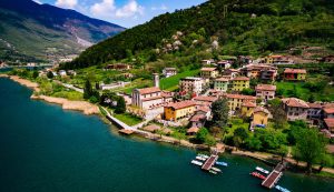
A wide-ranging loop itinerary takes you through the beautiful hills surrounding Zandobbio in a “horseshoe” shape. The route is not very technical and is accessible to riders of all skill levels. The description here follows a clockwise direction, but the itinerary can also be completed in a counter-clockwise direction.
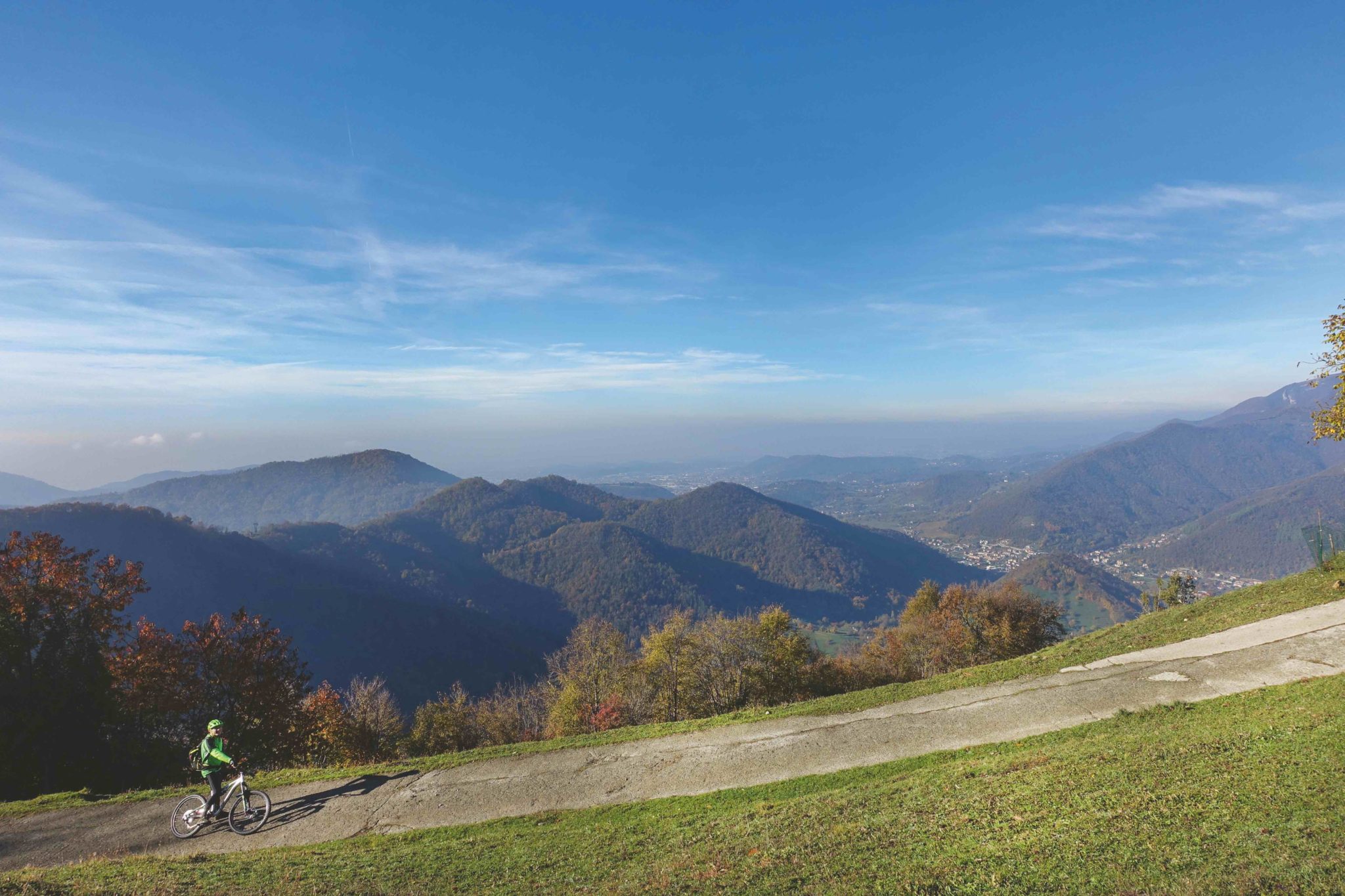
The first segment includes a climb to San Giovanni delle Formiche, offering gradual ascents and scenic views. The second segment traverses the area above Gandosso, passing through the Python Park and following a mostly flat path that provides an opportunity to enjoy the surrounding landscapes.
The final segment features a beautiful descent that leads to Golf Rossera, followed by a gentle ride further downhill towards Gorlago. The route concludes with a return to Zandobbio along the pleasant Gabbione path, making for a relaxed and enjoyable finish.
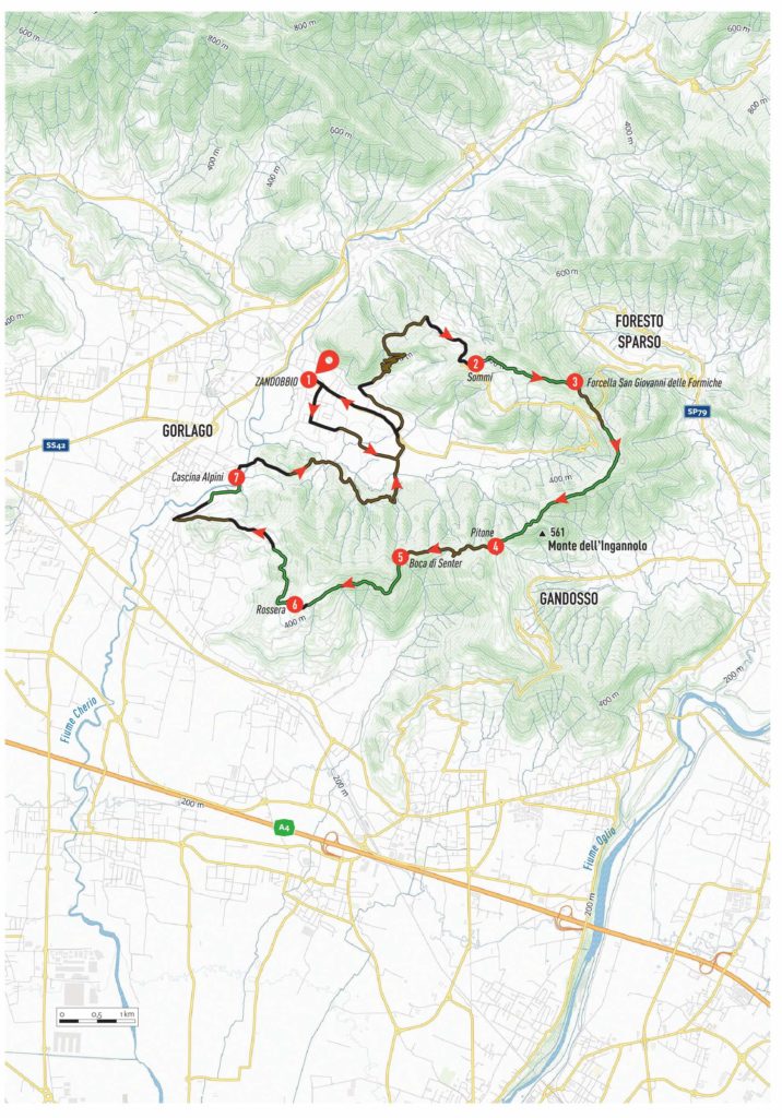
ITINERARY DESCRIPTION
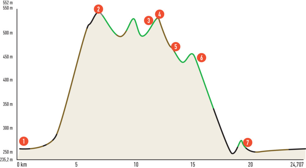
Starting from the Piazza Giovanni XXIII car park in the centre of Zandobbio (1), take the road to the left and follow it to the first right turn onto via San Giorgio. Continue until you reach the cemetery, where you turn left onto via Fornaci and follow it straight, without deviations. The road becomes unpaved, and at the first fork, keep left until you intersect the road leading to Selva di Zandobbio. Follow this road for a short distance to the left, then take via alle Cave on the right, followed immediately by the dirt road via Carrecio on the left. This leads to via Madonna della Neve, and eventually to the crossroads with via Sei. At the end of via Sei, turn right onto via Grena, where a yellow sign marked “Grena” opposite the quarry entrance indicates the start of the first climb.
This initial climb is pleasant, with nine hairpin bends on an unpaved road. Follow it without any detours until you reach via Corni, a paved road coming from Entratico. Turn right and continue climbing towards the Sommi peak (2). When the road begins to descend, take the dirt road on the left, following signs for San Giovanni delle Formiche (CAI signpost 616). Shortly afterward, take the path on the left, which undulates before reaching a wide dirt track near a farmstead surrounded by chestnut trees.
From here, follow the dirt track downhill to the right, following signs for Carobbio degli Angeli (CAI signpost 650). A winding, scenic path leads to a paved road from Foresto Sparso. This marks your arrival at Colle di San Giovanni delle Formiche (3). Continue along via San Giovanni, climbing until the first hairpin bend, where a road on the right enters dense woodland. This road, with some ups and downs, leads to a dirt track that separates Val Cavallina from Valle di Gandosso. Follow this track until you reach a hut. Here, the track becomes a path that starts flat, then descends to another hut, where you continue to the right. After a brief climb, you will reach Python Park (4).
After crossing the adventure park, with its unusual rock formations and centuries-old plants, you will arrive at the Alpini building, a great spot for a well-deserved rest. Climb the steps near the fountain to access a dirt road and descend to the left. At the crossroads, take the first dirt road on the right, signposted for Santo Stefano – Gorlago (CAI marker 650). Soon, you will arrive at Boca di Senter (5), a large clearing with multiple trails. Take the “coastal path” on the left, following signs for Golf Rossera (CAI trail sign 798). This pleasant trail leads to a small clearing with a fork; here, take a sharp right downhill.
The trail continues with technical and flowing sections until it intersects a dirt track. Shortly, you will reach a large gate that must be opened and closed to proceed onto the paved road from Chiuduno. Follow this road uphill to reach Golf Rossera (6). Pass discreetly through the golf course area, avoiding disturbances, and head to the far right. Through an iron gate (which must also be opened and closed), take a path on the left that descends alongside the golf course fence. Soon, the path veers sharply right. Follow it without detours until it merges into a large dirt road.
Descend this dirt road until you reach a fork with a stand. Here, go left down via Doria. At the next fork, turn right downhill onto via De Gorsa, following it to the end. At the top, turn right towards the Alpini di Gorlago. Continue along the paved road, and at its end, on the left, take a pleasant trail leading to the Cascina degli Alpini di Gorlago (7).
Leaving the farmstead behind, cross via Montecchi, turning right and following it uphill to its summit. Descend along a cemented road, which soon crosses the Malmera stream. At the next fork, turn right onto a dirt road marked with signs for Cascina Gabbione (CAI trail sign 651B). Pass through a gate and follow the dirt track, taking a sharp right turn at the top of a short climb. The dirt road soon becomes a path.
Continue along this path, enjoying some gentle ups and downs, until you pass a hut. Descend to the left onto a dirt track, and follow it downhill without detours. After crossing a small bridge over the Malmera River, continue straight, and at the first fork, turn right onto the dirt track of Via Fornaci. When this intersects with a paved road, turn left. A short ride will bring you back to the Piazza Giovanni XXIII car park, your starting point.
Edited by Stefano Codazzi
Scan the QR code to get information about the parking

