ZANDOBBIO – ROSSERA – GANDOSSO – CAROBBIO DEGLI ANGELI
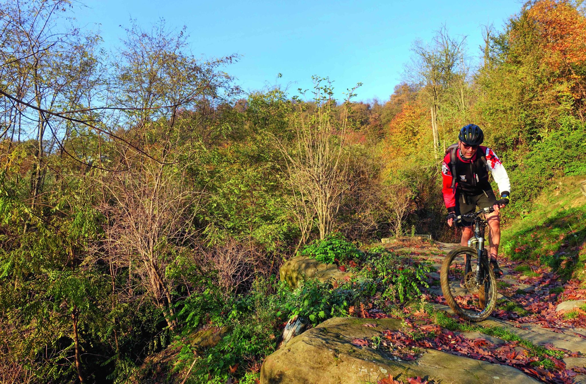
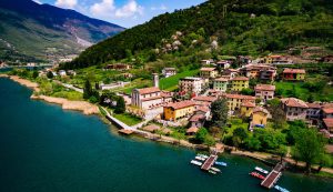
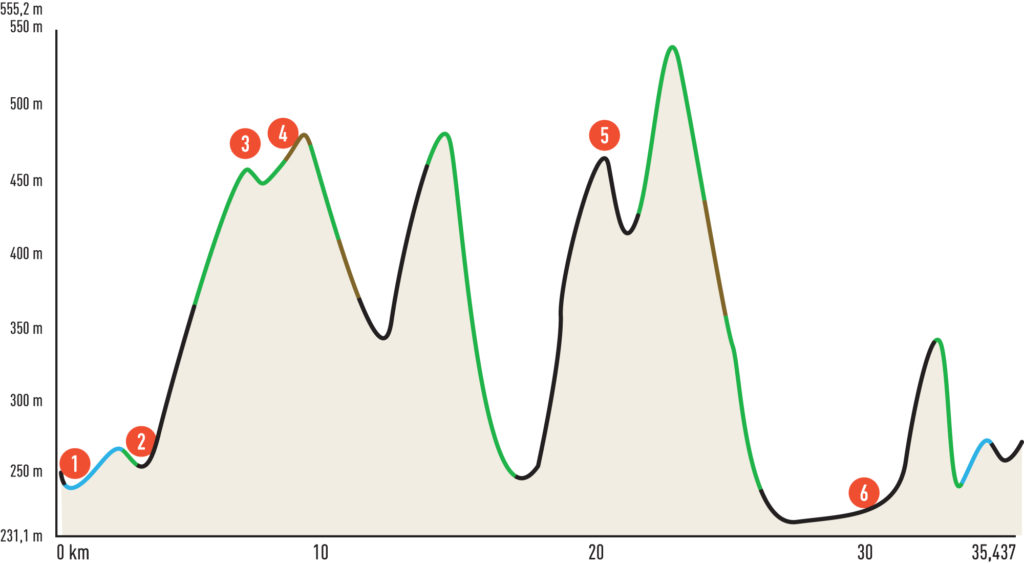
This is a beautiful and wide-ranging circular route that covers some of the best trails in the hills between Zandobbio, Carobbio degli Angeli, and Gandosso, offering excellent views—first over the plain and later towards Lake Iseo. The first challenging climb takes you to Gold Rossera and then to the pass for Gandosso. The second climb, on a mix of asphalt and dirt roads, brings you back to Gandosso and then to the highest point of the route, near the summit of Mount Castello. The third climb, passing through the hamlet of Santo Stefano di Carobbio, leads to a descent toward Zandobbio.
The route features three main descents, each with increasing technical difficulty. The first descent, along the smooth and flowing Spondù trail, takes you to Boca di Senter and continues on the more technical Fontane trail. The second descent, on the wide and fast Terre Rosse flow trail, is ideal for those who enjoy speed on grippy clay terrain. Finally, the third descent — comprising the Aquedotto and Tedù trail — culminates with the Enchantment in the Valle del Fico trail, delivering the most thrilling experience of the day. This final section features numerous forested switchbacks and a technical trail with pebbles and natural steps, providing a perfect conclusion to the adventure.
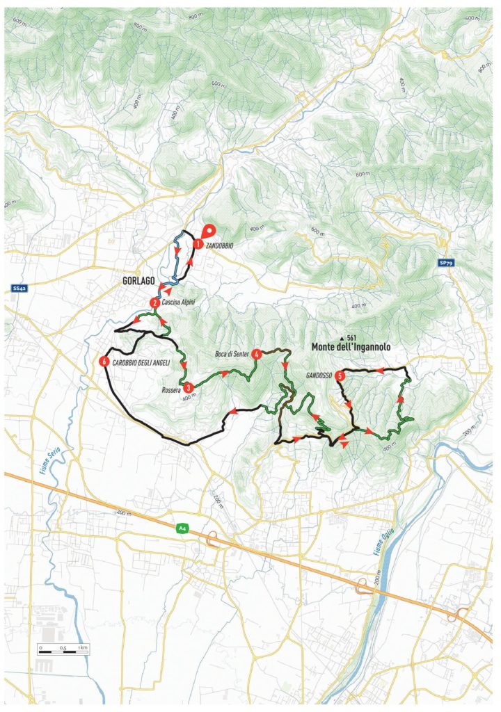
ITINERARY DESCRIPTION
Starting from the center of Zandobbio (Piazza Giovanni XXIII car park) (1), descend to the right towards the Cherio bridge. Just before reaching it, turn left and follow the Val Cavallina cycle path along a dirt road, entering the Malmera, Montecchi, and Colle degli Angeli PLIS. Continue on the cycle path until the end of the concrete road. At the crossroads, turn first right, then left towards the Alpini di Gorlago farmstead (2). Pass the farmstead and take the path marked “Golf la Rossera” (CAI 799).
At the end of the path, continue on the asphalt road until you turn left onto via De Gorsa (uphill), leading to a small “tribulina” (shrine). From here, take the asphalt road to the right, which transitions into a dirt road and finally a footpath, leading towards the Rossera Golf fence (3). Pass through the gate and ascend the steep cemented road on the left to the Golf Rossera clubhouse. Descend along the asphalt road, and at the first bend, take the dirt road. After passing through a large gate, follow the Coste path, marked with signs for Boca di Senter (CAI 798).
Stay on the path, navigating ups and downs while keeping to the right. Shortly after passing a hut, continue right again, pass some picnic tables, and take the uphill path towards Pian dei Roccoli. Upon reaching the top, turn left onto the flowing Coste path, which leads to the Boca di Senter clearing (4). From here, follow the dirt road towards San Giovanni delle Formiche. At the crossroads, turn immediately right onto the technical Fontane path.
Rejoin the dirt road, turning left until you meet the asphalt road. Continue downhill to the left along SP82, following it uphill to the summit, Tribulina della Sella. From here, head towards Sarnico and take a path leading to a clearing. Enjoy the wide, flowing trail as you continue along the ridge, eventually turning sharply left towards the Gandosso plain (5) via the Pavone descent.
Reach SP82 via dirt tracks and follow it uphill to the summit. Descend towards Grumello, then shortly after, turn right uphill on the Codera locality road. Turn right again toward the church of the Alpini. Follow the tarmac road, which becomes a dirt track after a barrier. Continue uphill until the dirt road transitions to a scenic path with three hairpin bends. At the highest point of the route, take a marked diversion to the left, where the Tedù and Aqueduct single tracks begin.
Follow the path to a fork, turning left onto a more defined trail. This leads to a dirt track, which you follow to the right, descending gently until reaching a deviation marked by an iron post. Turn left onto the enchanting single track, characterized by technical sections, rolling terrain, and ups and downs. A marked diversion to the right descends via numerous switchbacks into the Fico Valley. Once on the main path, turn right and shortly after, left to ford the Tirma stream. Pass several farmsteads and arrive on via Val del Fico.
Follow via Val del Fico downhill, then turn right onto via Rimembranze and later via Storti, arriving at the Chiuduno crossroads. Take SP91 to the right towards Carobbio degli Angeli (6). Follow the road for a few hundred meters, then turn right into Via Suardo. Continue straight without deviations until reaching the petrol station. Turn right onto via Marconi and follow signs for Santo Stefano. Enter piazza Locatelli and follow via Roux through the village. Take the uphill via Alla Chiesa, which transitions to via Doria.
At the “tribulina,” take the asphalt road on the left. Shortly after a barrier, it becomes a dirt road. Follow the trail marked for Cascina degli Alpini (CAI trail sign 655). This final descent, featuring a mix of steps and fast bends, leads to the Cascina degli Alpini farmstead. Retrace the initial stretch of the cycle path in reverse, arriving at the small wooden bridge over the Malmera stream. Shortly afterward, climb the concrete road on the right, reach via Rivi, and follow it to its end. Turn right onto via Grappa, arriving shortly at the car park where you started.
Edited by Stefano Codazzi
Scan the QR code to get information about the parking

