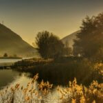
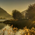
Bike Italia undertook a cycling adventure to discover Lake Endine: 60 km by bike from Nembro on a scenic route through the Val Cavallina valley. Here is an extract from the article published on their portal.
“This lake, like many others, has two names: Endine and Spinone, which correspond to the two towns located respectively to the north and south of the basin.
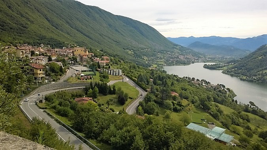
The lake is wedged into a very narrow valley, surrounded by mountains approaching 1.400 metres. Fortunately, the natural environment is still intact, so much so that it is considered an area of “outstanding environmental interest” and protected as a park. On the banks are reed beds, breeding grounds for fish and birds, and even small beaches that are very popular with tourists.
The route begins at a car park near the Nembro cemetery. Take via Marconi and, after crossing the Serio river, turn left in the direction of Albino and Pradalunga.
After 3.5 km of road running between houses and walls of old factories, without ever catching sight of the river, you reach a crossroads where you turn right for Fiobbio and Abbazia.
Just before the turn, on the left, beyond the road bridge leading to Albino, you will notice what appears to be an old bridge, now used as a cycle path.
Continue for a further 4.5 km until the right turn indicating the Benedictine Abbey (after which the small hamlet of Albino is named). It is a few metres of diversions, but well worth it. The origins of the abbey date back to the early part of the 13th century.
After leaving the abbey behind, we return to the SP39 in the direction of Casale.
The first undulating sections of the route begin to emerge, the traffic is moderate and the view takes on the typical tones of the Bergamo mountains.
The landscape suggests the start of the ascent to the Colle Gallo Sanctuary.
At the sight of the gigantic cross, the sanctuary cannot be far away. In fact, exactly 450 metres later, there it is: a place that can rightfully be called the “home of cyclists”.
The descent begins and, after 8-9 hairpin bends, we reach Gaverina. Along the way, one notices how the churches are often located in dominant positions.
After passing Casazza, the route continues towards Monasterolo del Castello.
The ruins of the castle are located just before the village, on the left, and the structure, which has been completely renovated, now houses a catering and events business.
Without visiting the ruins, continue to the well-kept and perfectly usable lakeside park, which offers a splendid view.
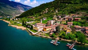
Skirting the lake, one arrives at San Felice, with its characteristic lanes. The narrow streets pass through rows of old houses, without the disturbance of cars, until you reach the church of San Michele Arcangelo, overlooking a square that laps the lake.
It continues to the end of the hamlet of Pura. After these few houses, the road gradually moves away from Spinone and then joins the SS42, which connects Lovere with the lake. Here we turn left onto the state road, then immediately right, taking a slightly uphill road towards Ranzanico. The attempt to reach the village fails due to a route error and, after an unexpected descent, you find yourself on the busy SS42. Turn right towards Bergamo and continue along the state road until the fork for Bianzano and Cene.
Following the signs, we reach a fork in the road, where a climb begins that offers the last glimpses of the lake now behind us. On the left you can see Ranzanico, which is not crossed, but immortalised by the uphill road. Shortly after Bianzano, you come to the Suardi Castle, which may date back to 1233.
We continue along the SP40.
A last glance at Lake Spinone or Endine, modest in size and depth, nestled between the mountains, but capable of exerting a particular charm, especially when illuminated by sunlight.
Now the descent leads to Cene, then the wheels turn on the road to Albino, where an ancient bridge awaits. This stone footbridge, built in the 14th century, follows the Romanesque style.
We retrace the same road as the outward journey and entering Pradalunga, without paying much attention, we notice a house with the inscription “Pietre Coti”. An immediate translation might suggest “Pietracotta”, but only at home, stimulated by the memory, do we delve deeper into the subject: Pradalunga is famous for “cote”, a particular stone used to sharpen knives and other cutting tools.
We finally find the car park and set off home. It was a very varied 60 kilometres: the first and last sections lacked attraction, but the central part, with the climb to the sanctuary, the subsequent descent and the tour around the lake, was very satisfying. The final climbs to leave Lake Spinone required some effort, but the long descent to Cene was the well-deserved final reward, like a dessert at the end of a meal.
This concludes this homage to Lake Spinone, without forgetting a fundamental detail: the lake is located in the heart of Val Cavallina.”
For the complete article and other routes:
www.bikeitalia.it
info@bikeitalia.it
